


Property Details
Price: $6,600,000
Address: 3051 McAnally Road
Type: House
Parking: Garage Double
Year Built: 1996
Taxes: $31,454 (2018)
Living Area: 7,128 sq.ft.
Lot Size Area: 1.59 acres
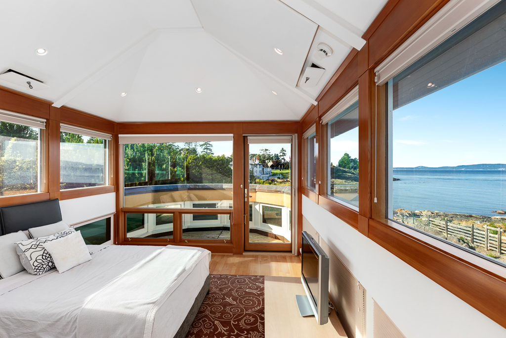
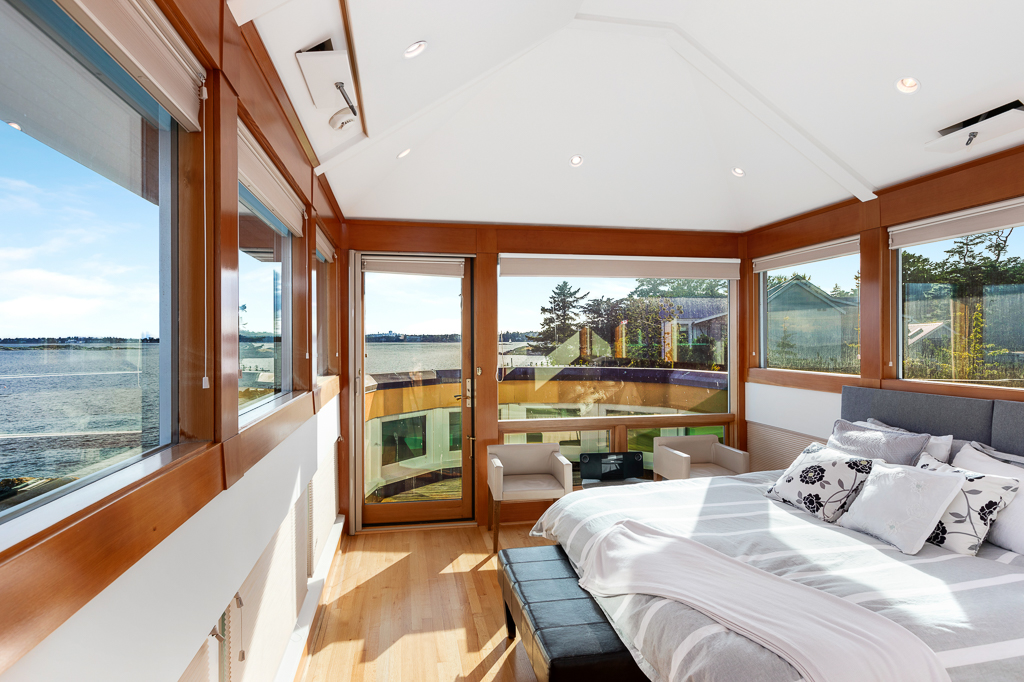
Bedrooms: 3
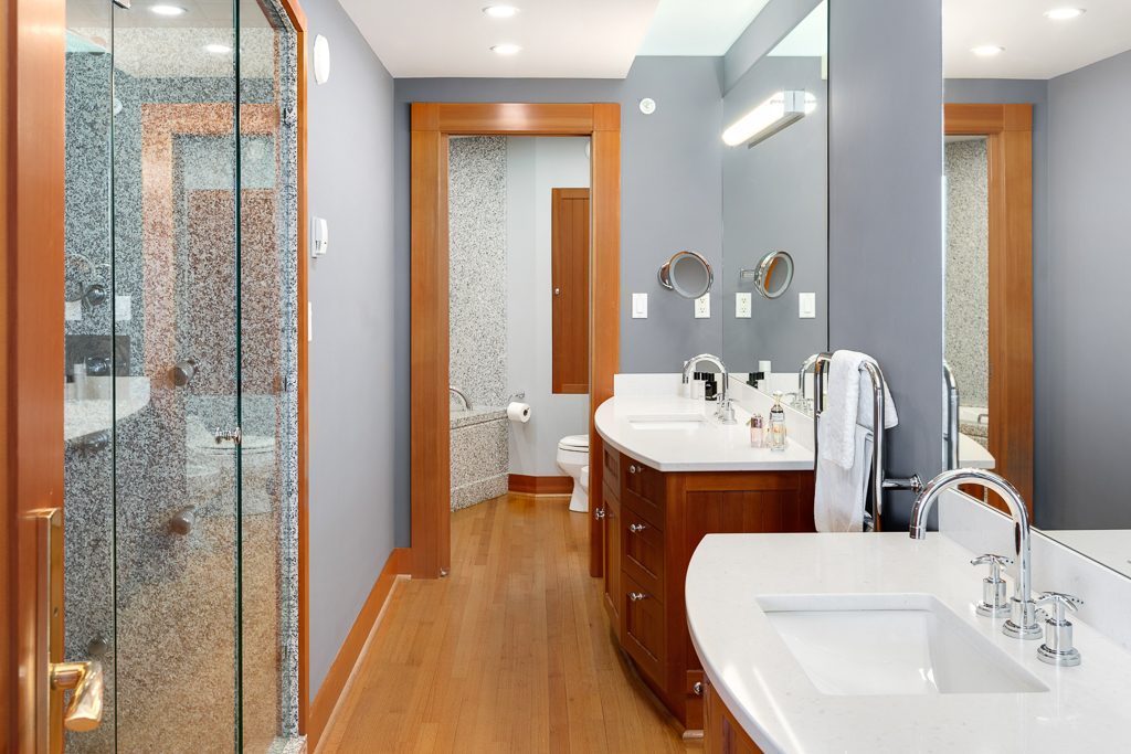
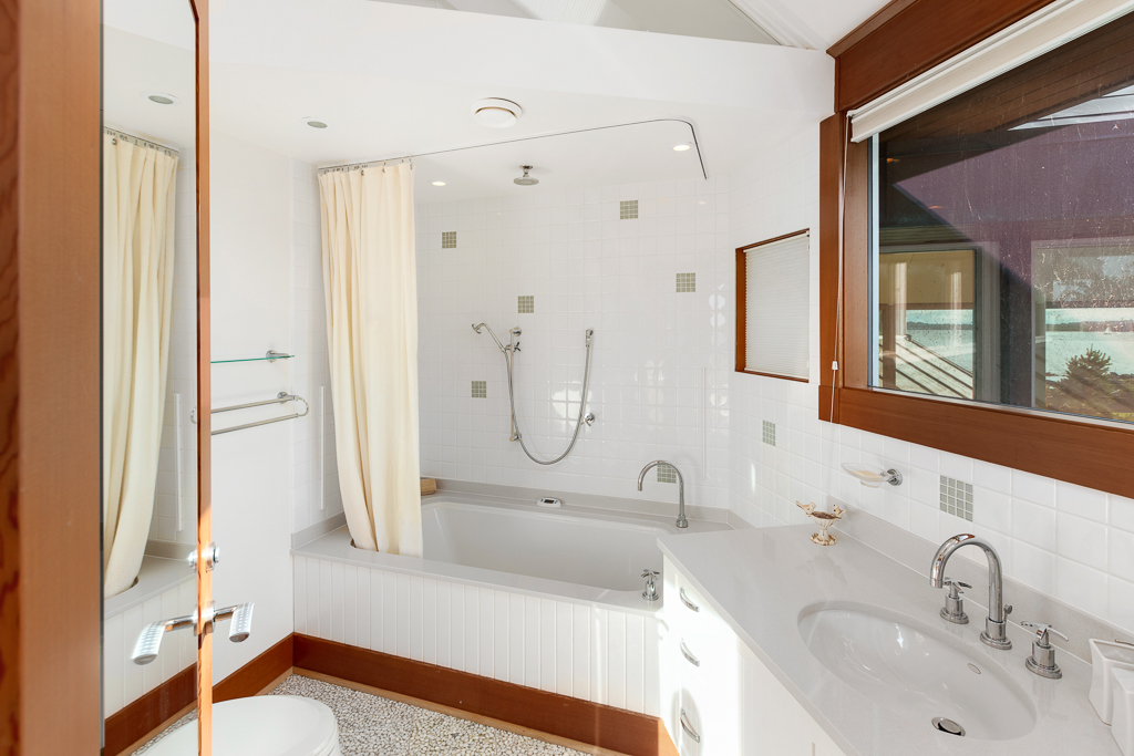
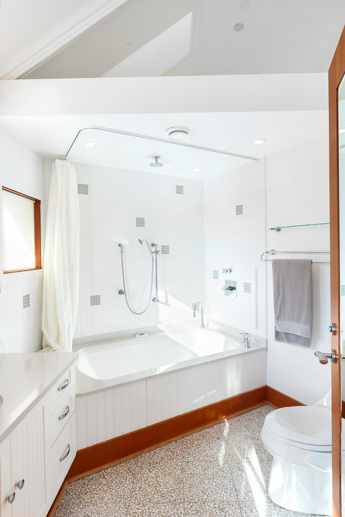
Bathrooms: 4 full & 1 half
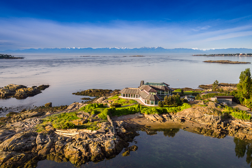
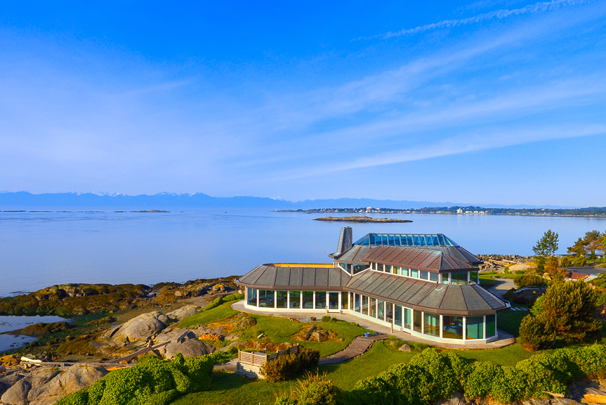
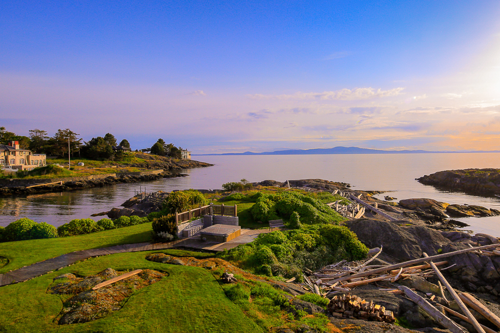
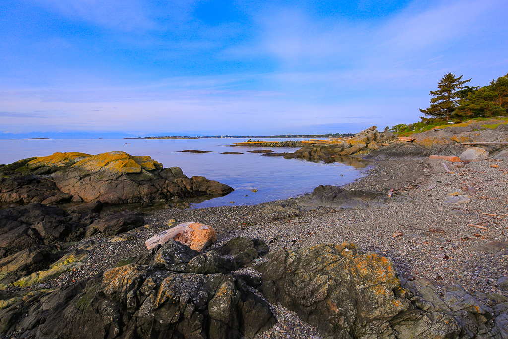
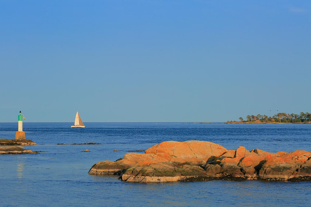
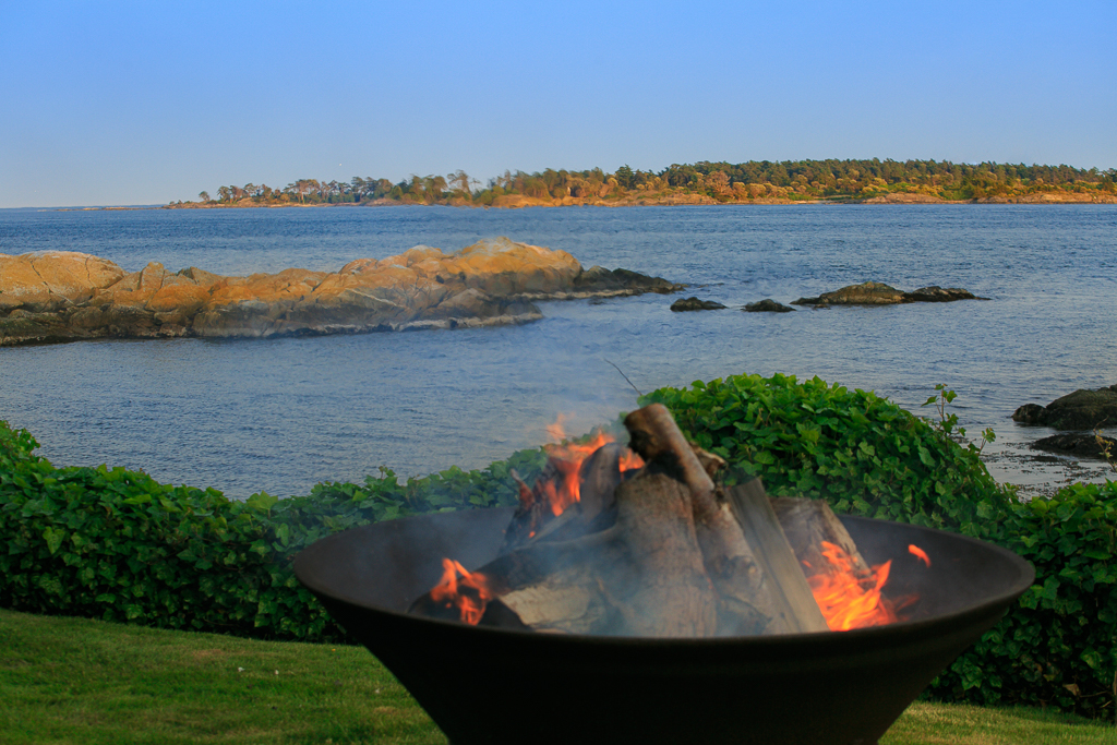
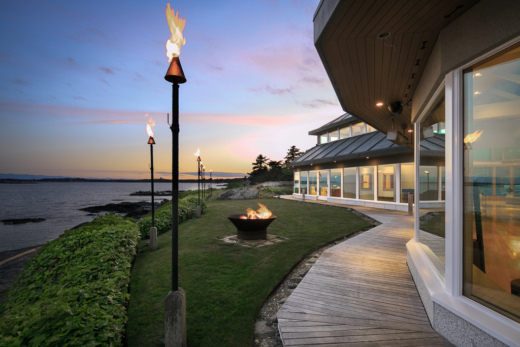
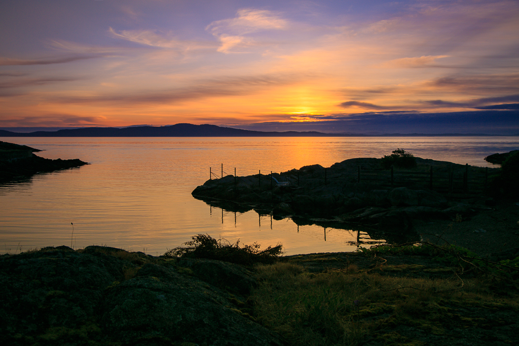
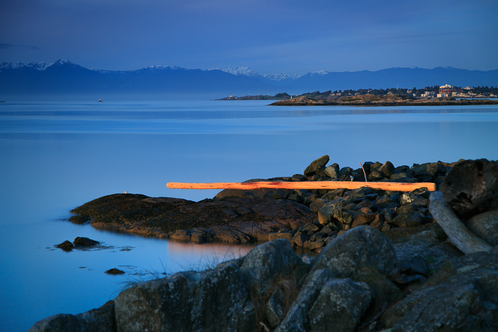
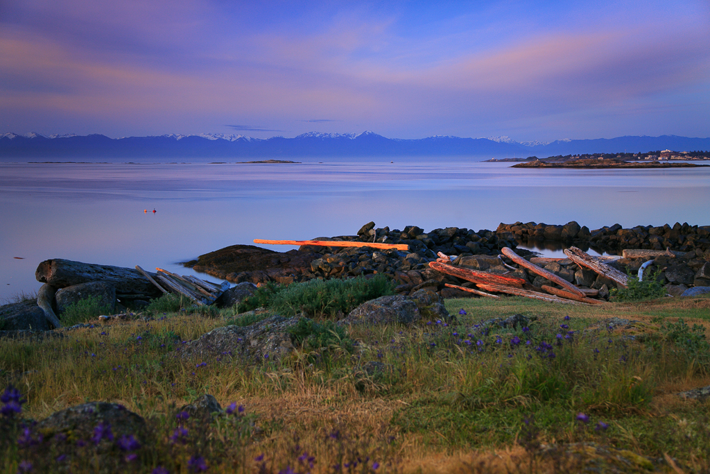
Ocean Frontage: Approx 1,200ft
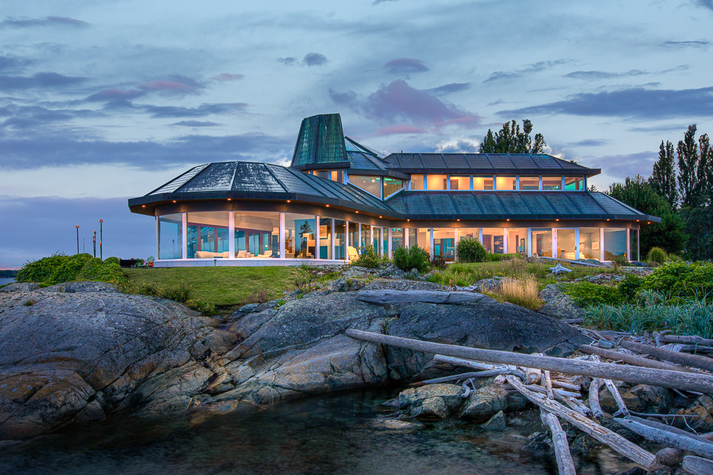
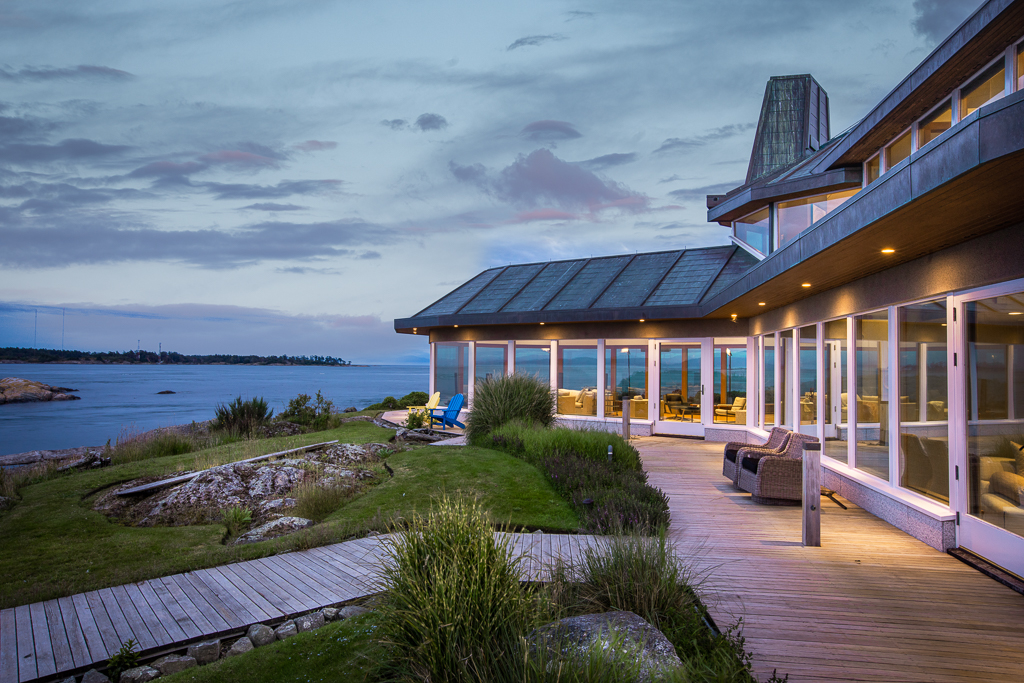
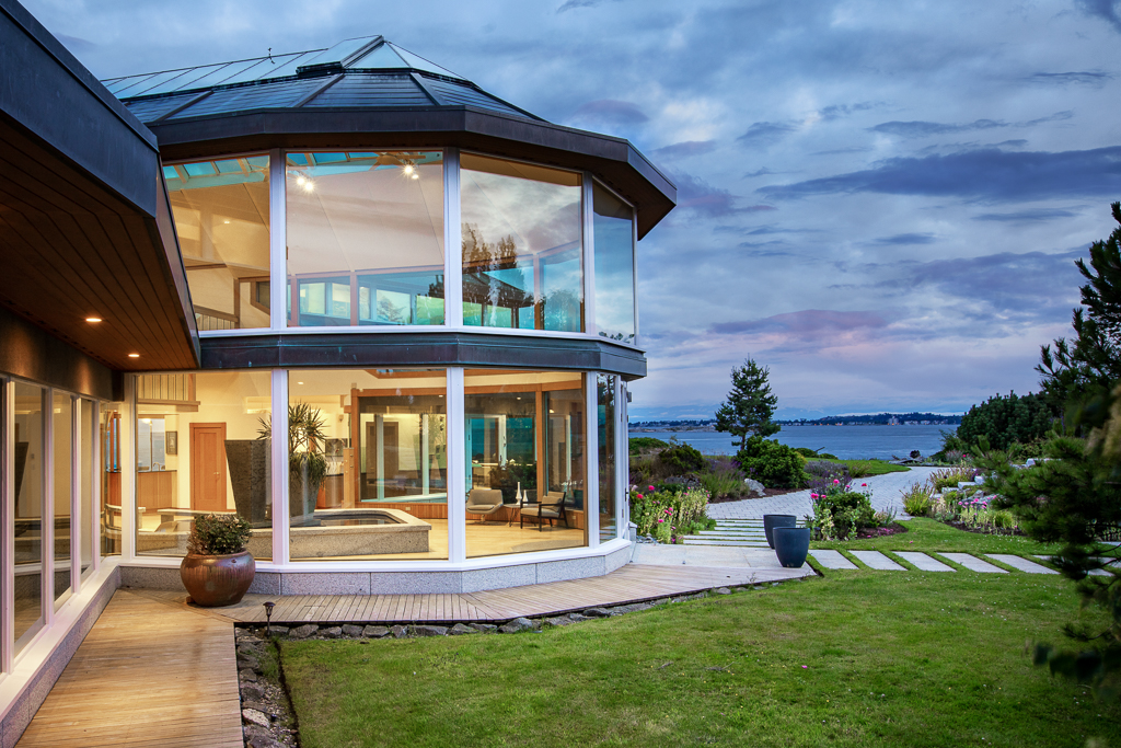
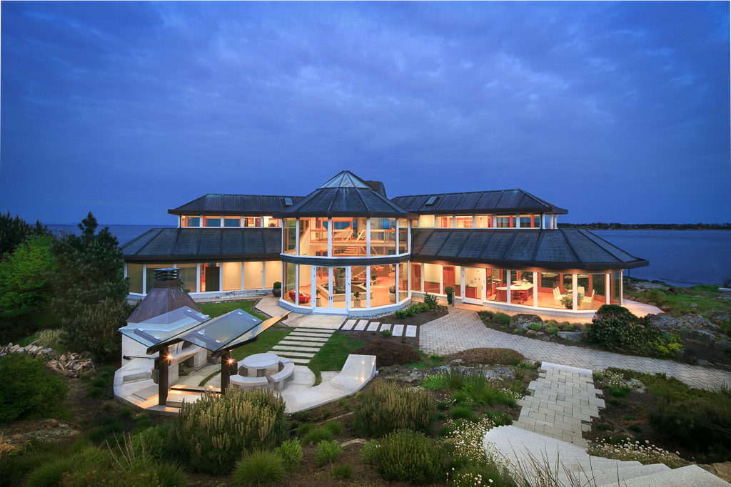
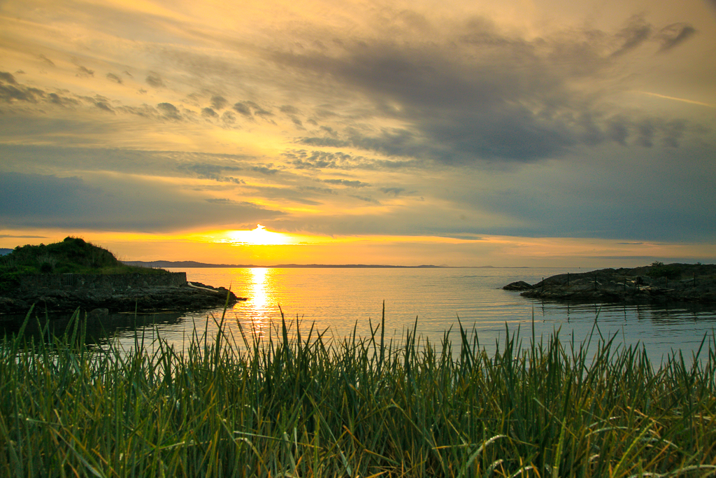
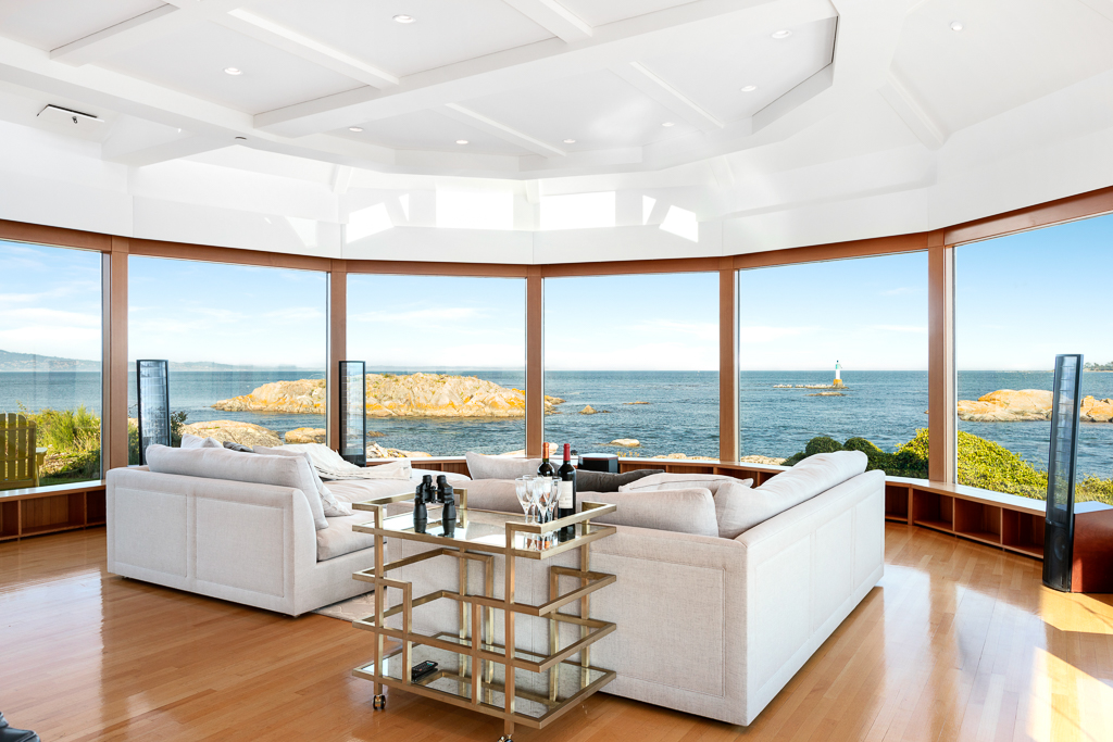
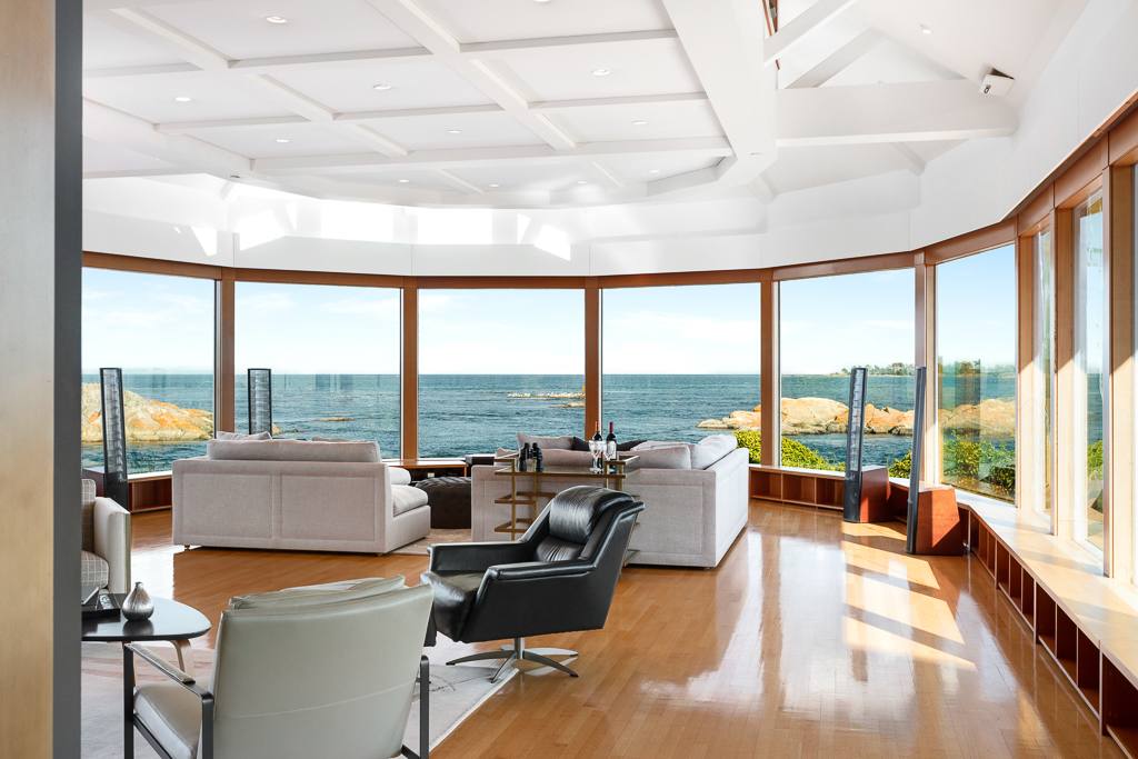
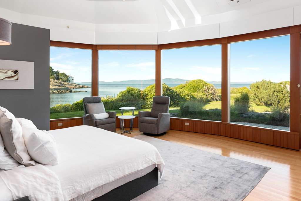
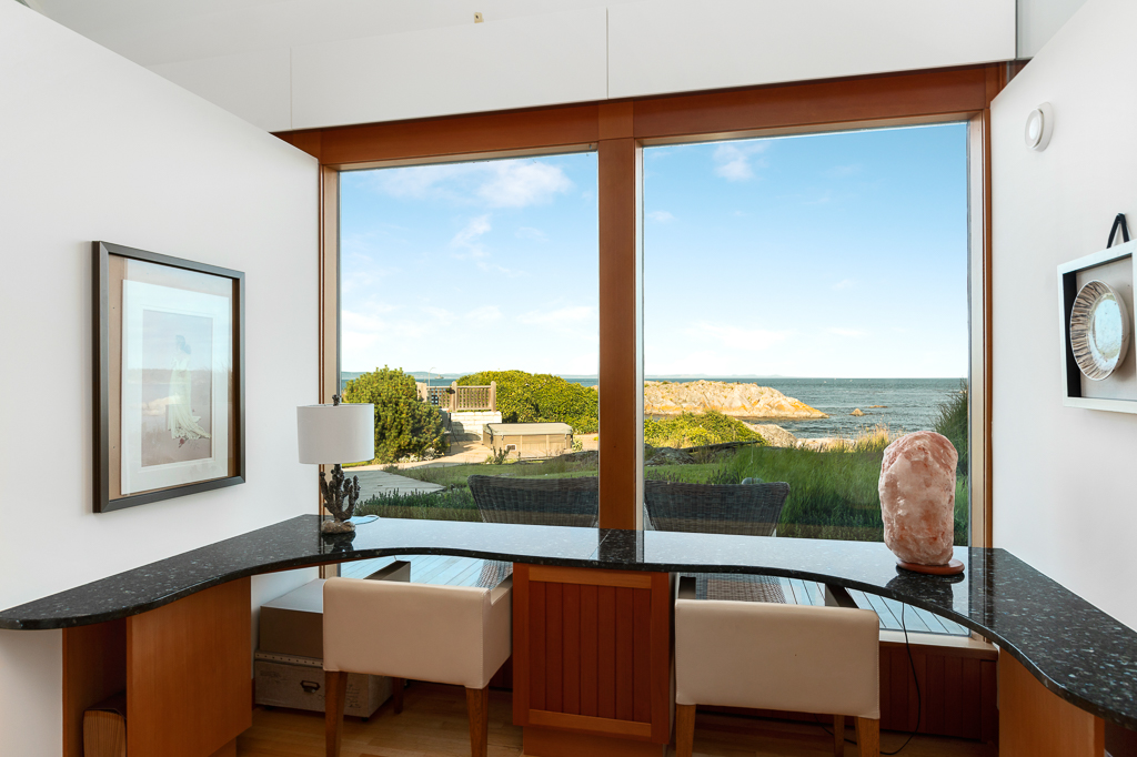
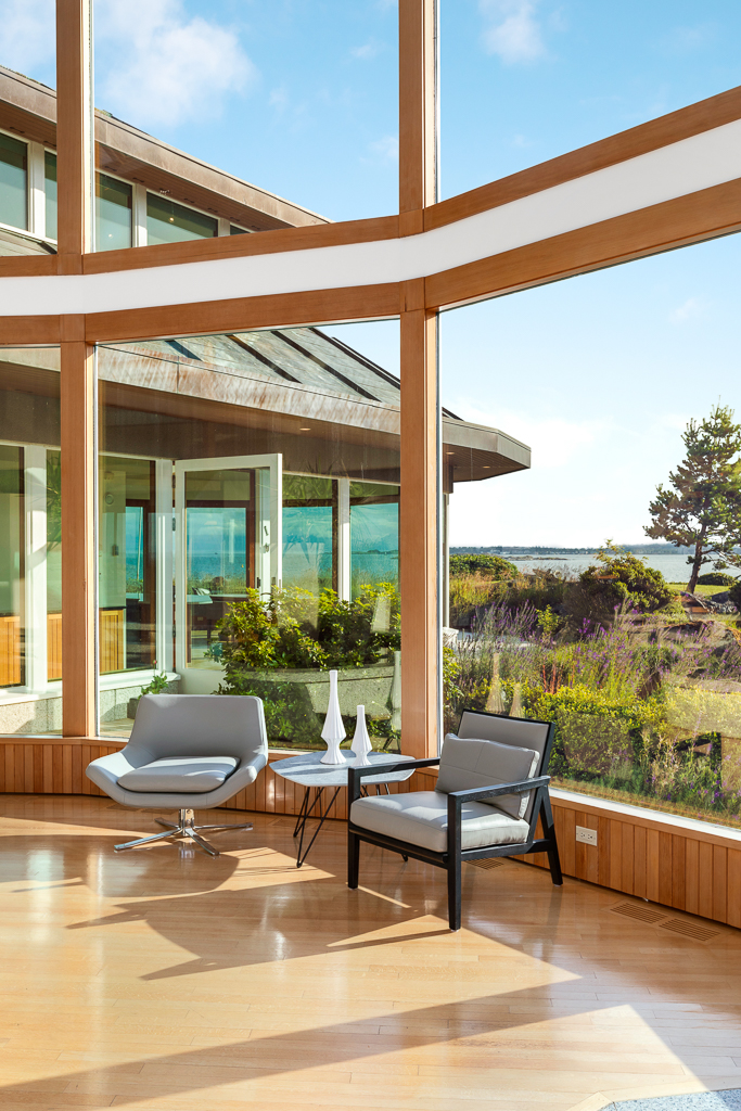
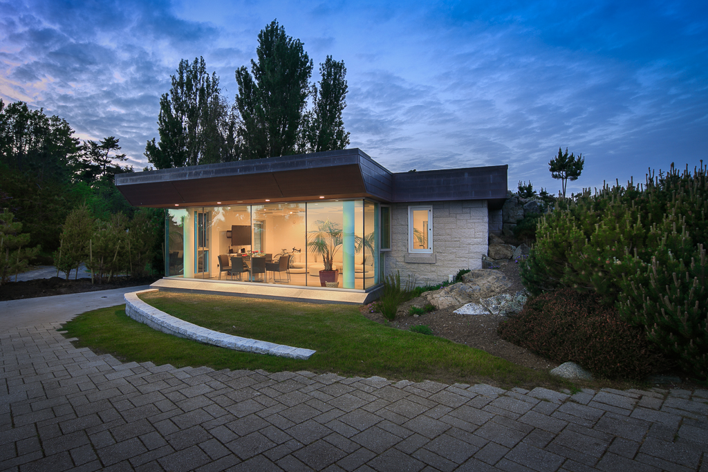
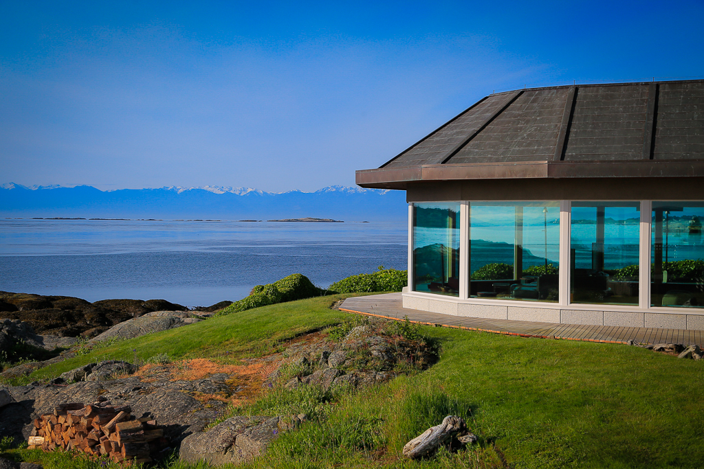
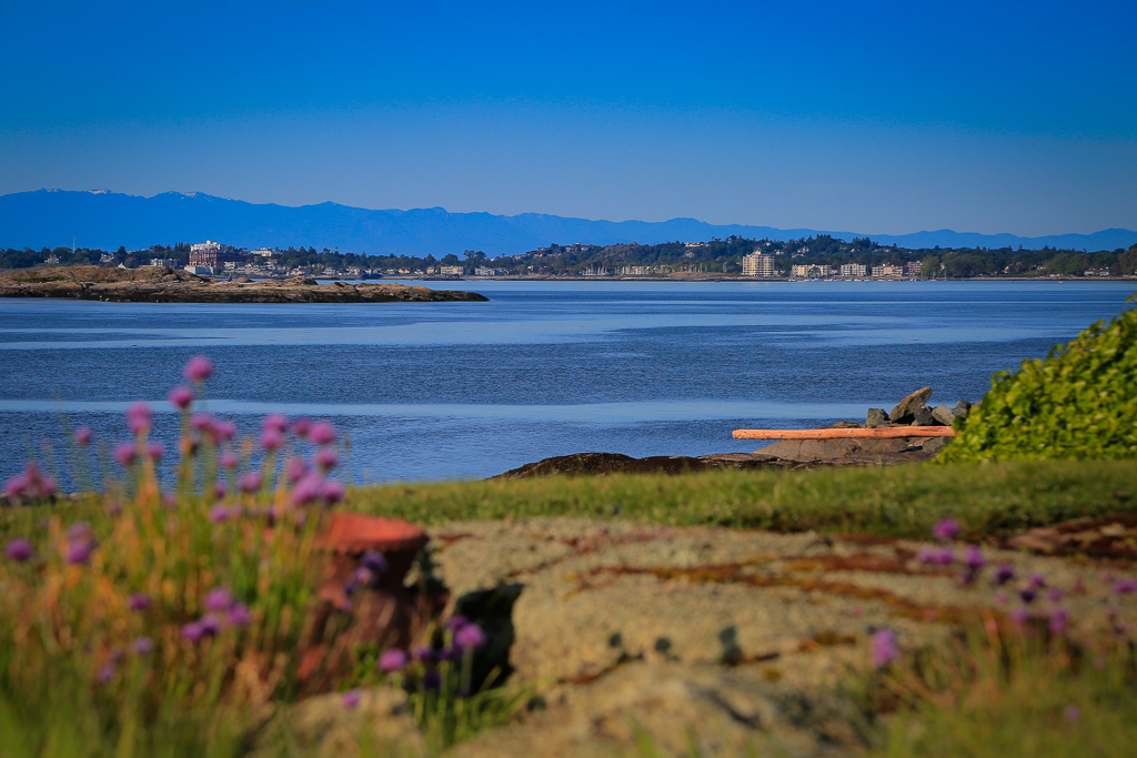
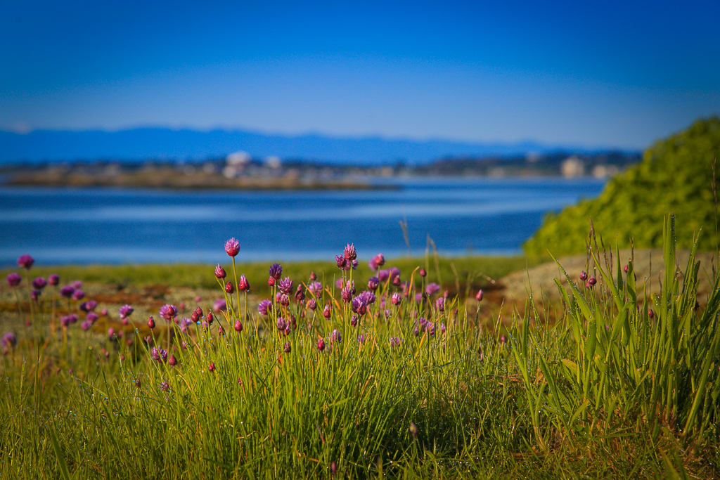
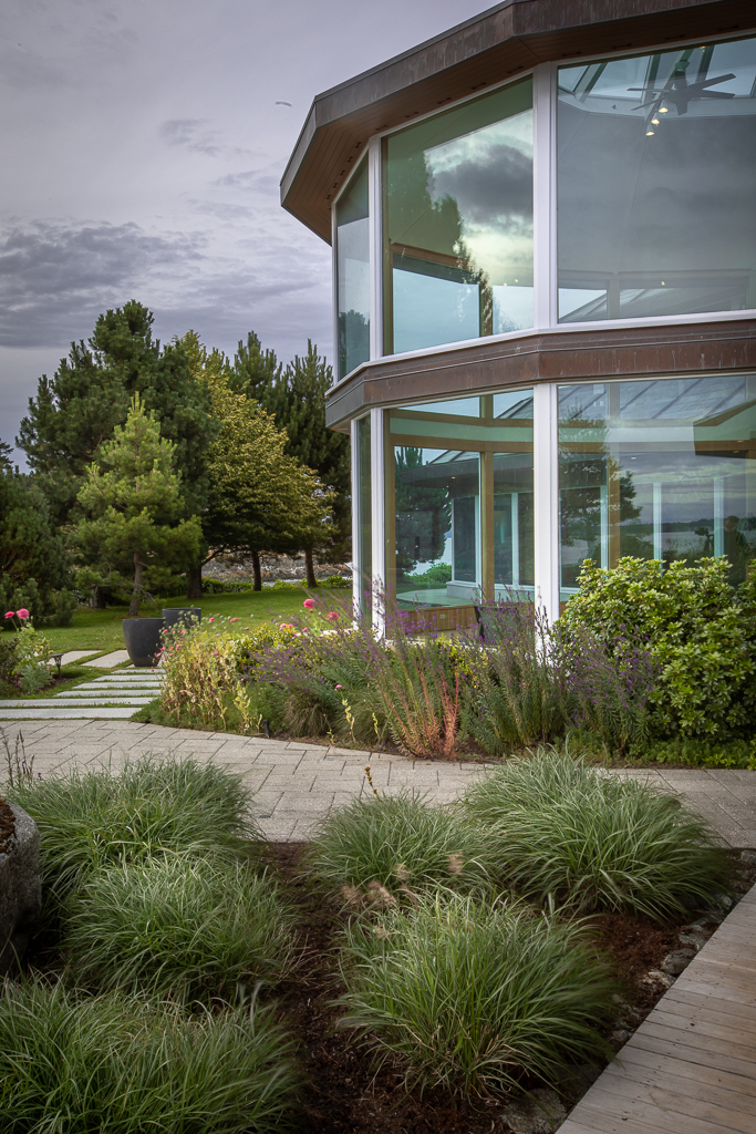
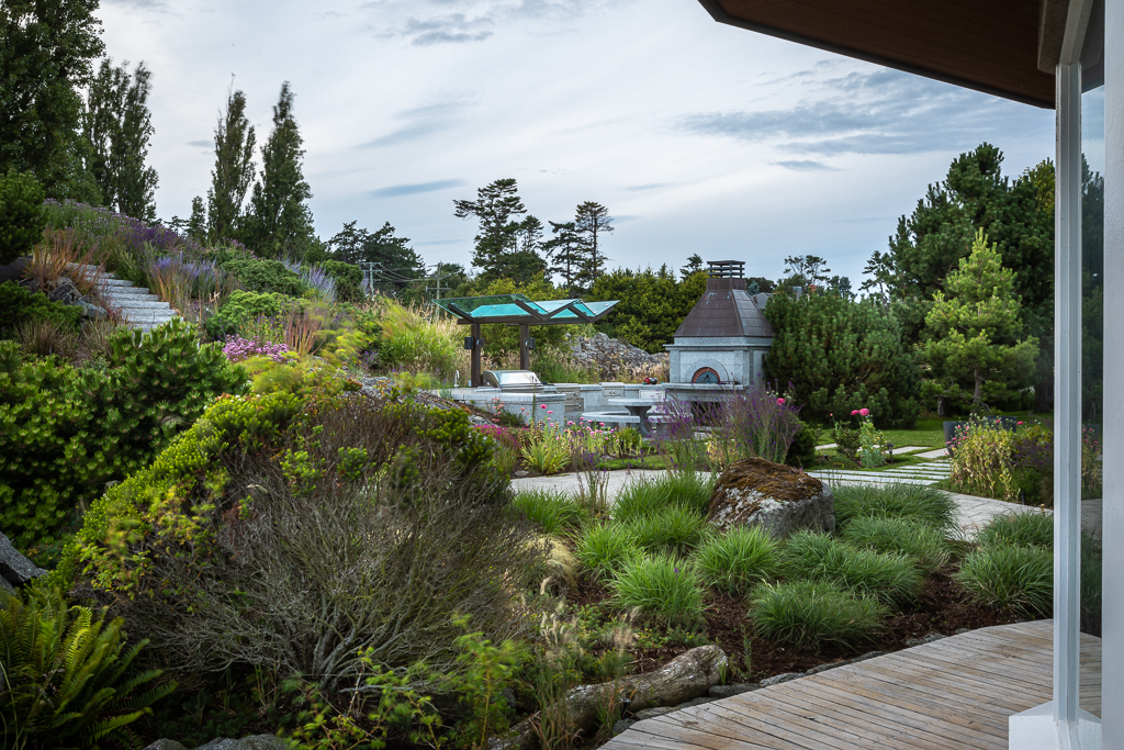
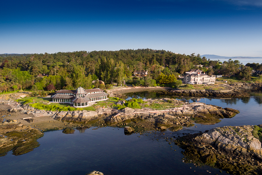
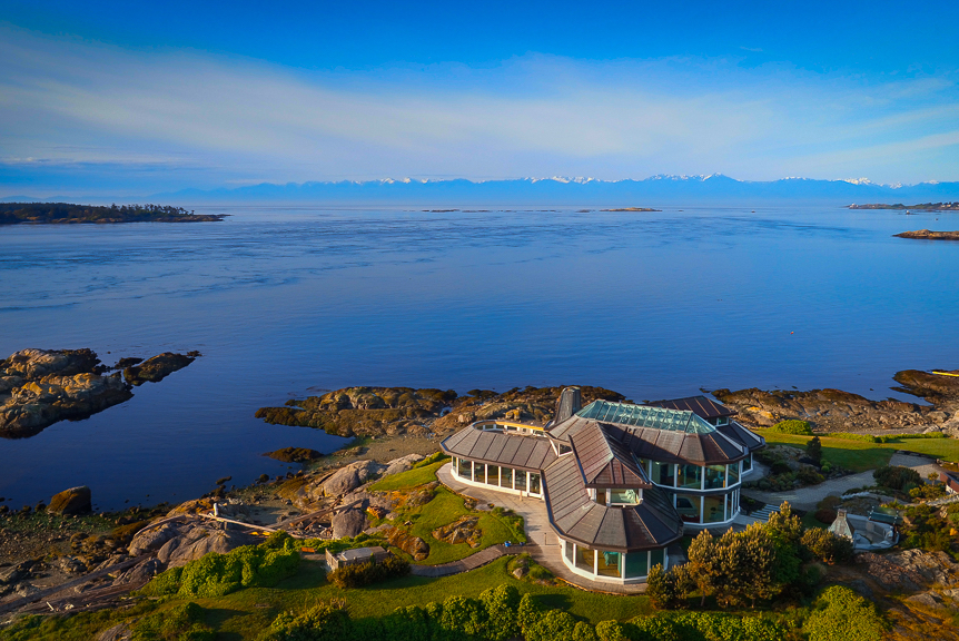
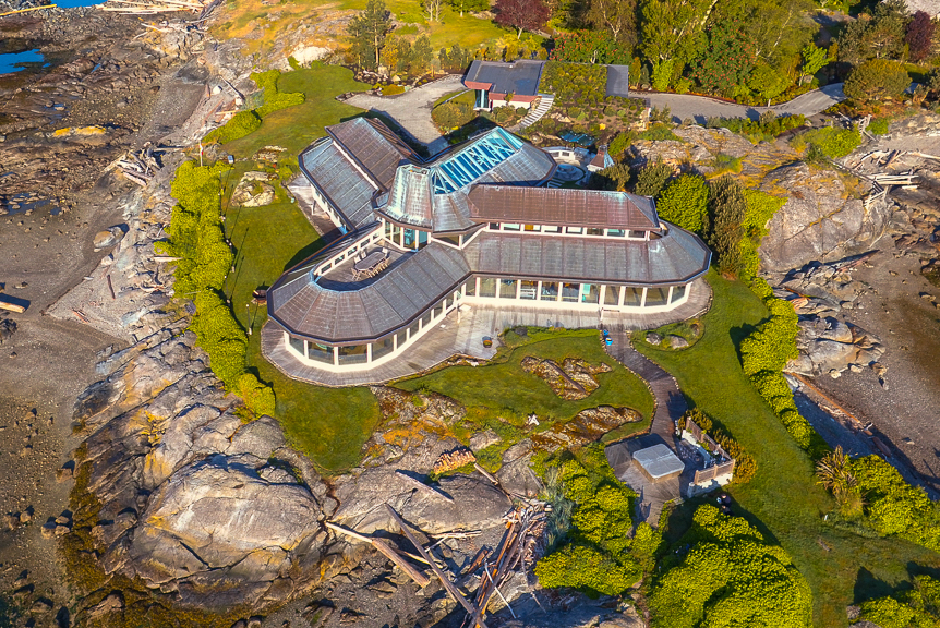
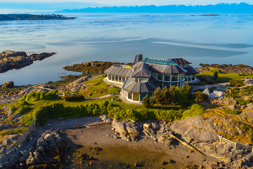
“The Point”. Be captain of your ship in this iconic glass house, built with cutting edge design to celebrate over 1,200 ft of ocean frontage and 270 deg. views of the surrounding west coast seascape and Olympic Mountains beyond. Perched on a 1.59 acre rocky headland with 2 private beaches at the edge of 10 Mile Point Ecological Reserve, the home is incredible.
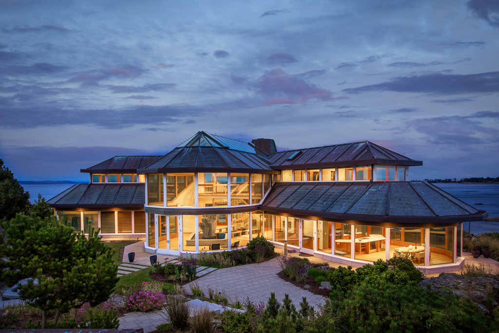
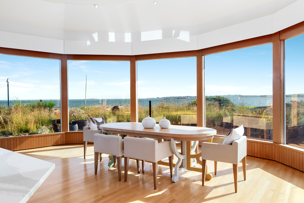
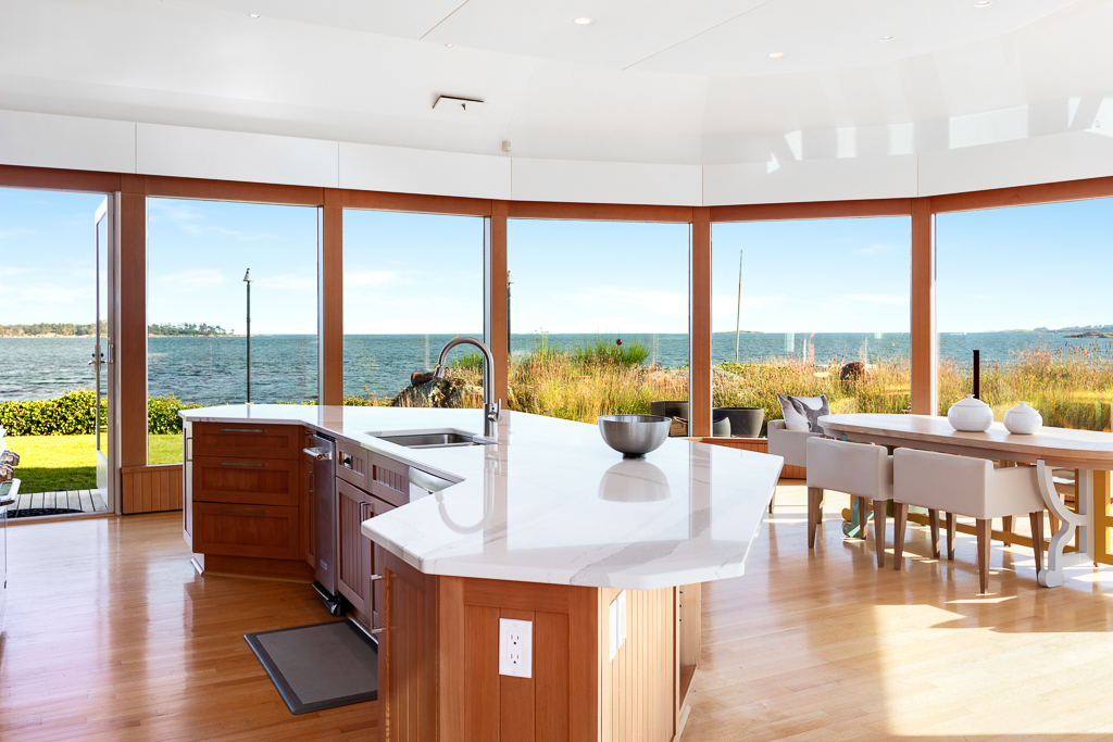
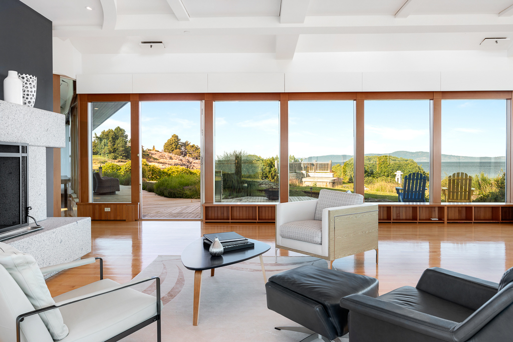
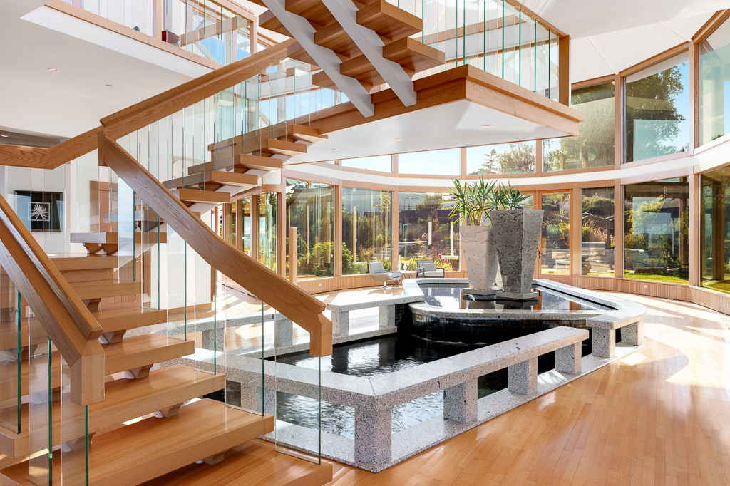
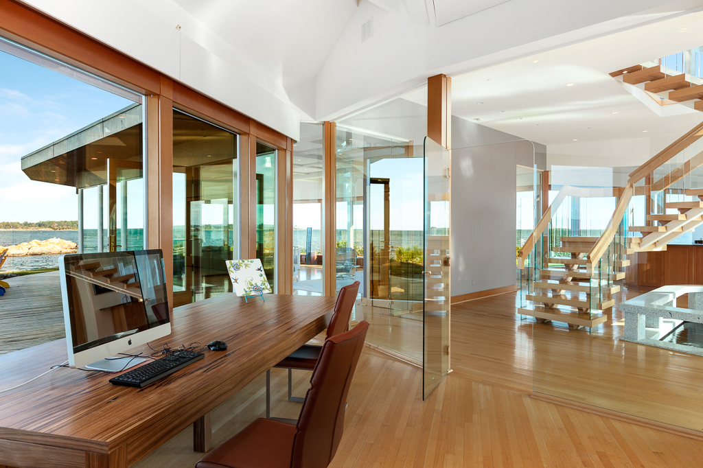
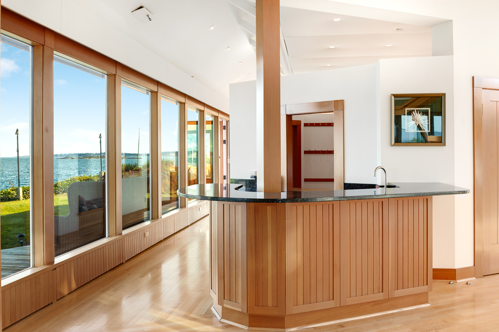
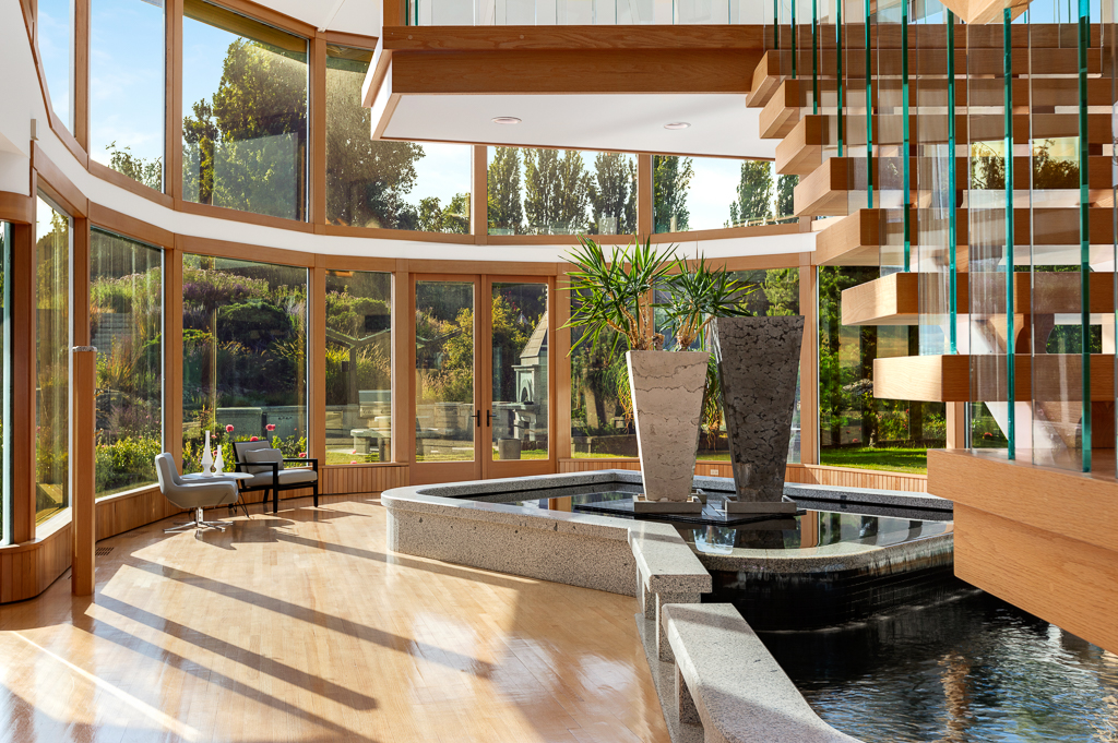
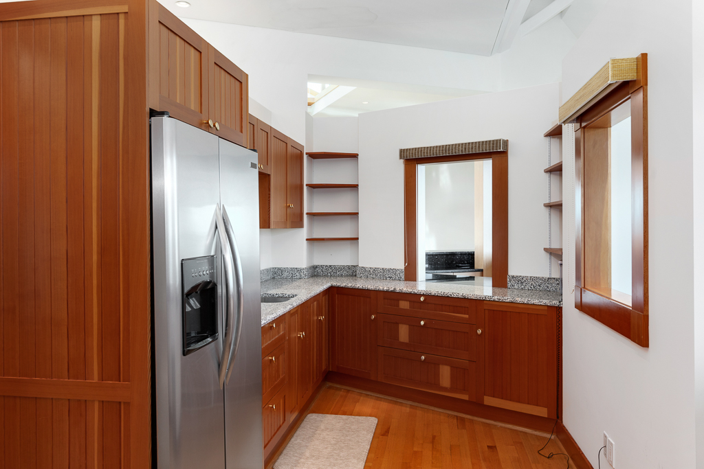
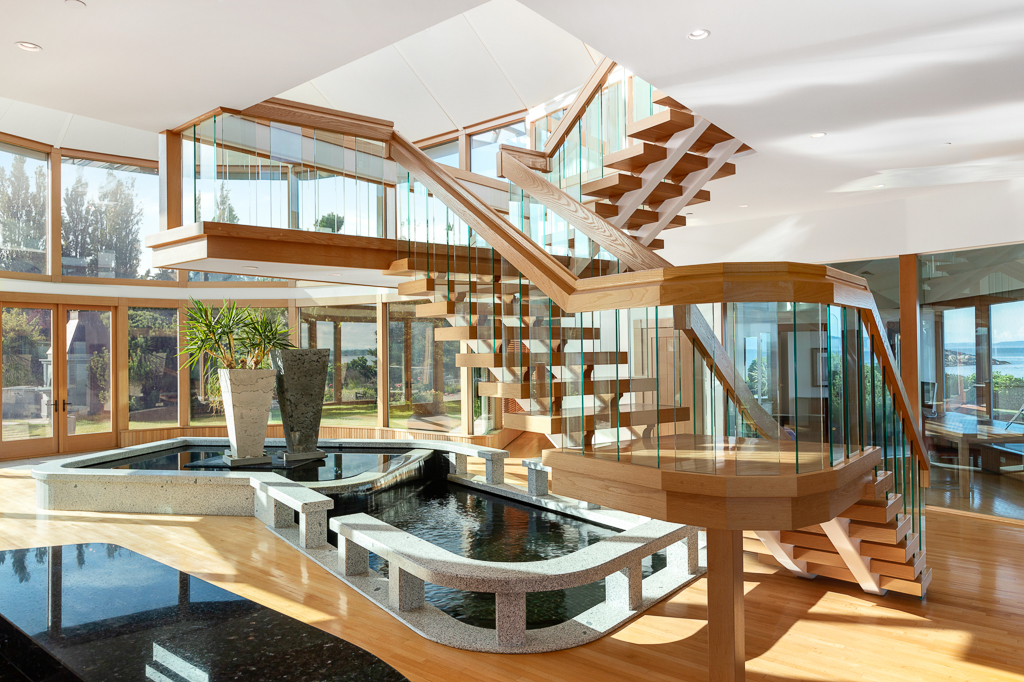
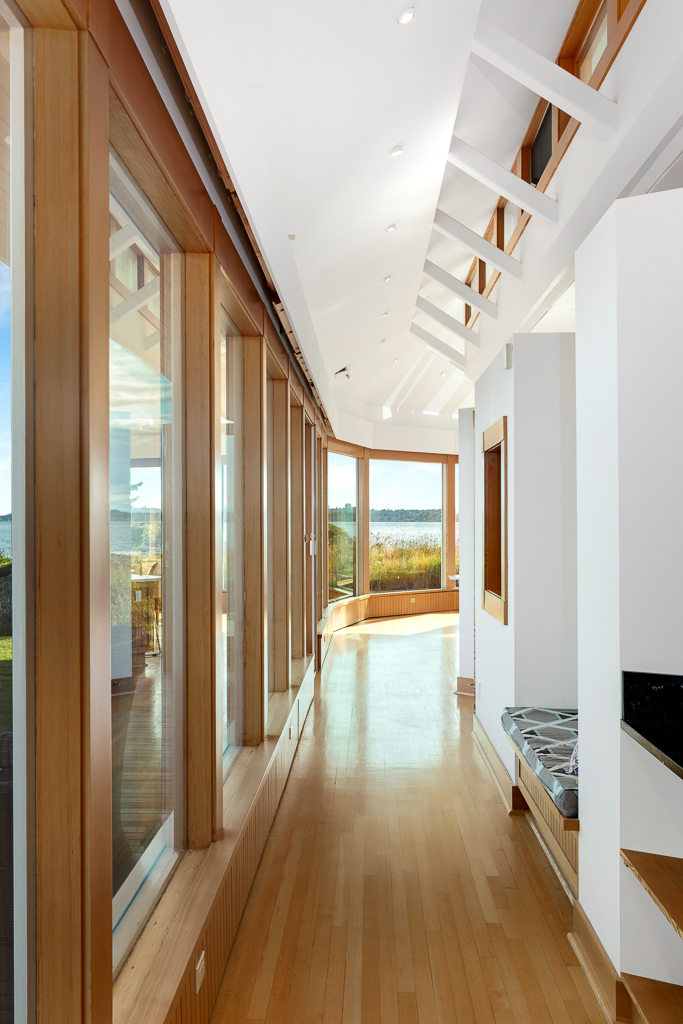
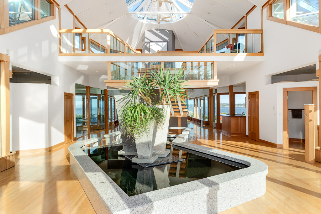
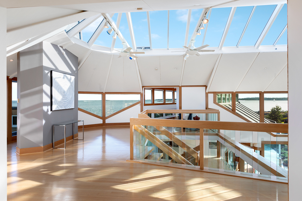
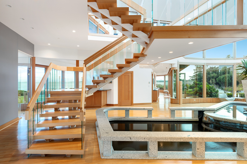
Three wings of glass abut a magnificent central atrium which vaults to 23ft. At the heart, a pond overflows into a lower pool, providing a natural cooling system, while a floating staircase rises above with effortless sophistication. At the pinnacle, the living room merges with the ocean to provide constant entertainment. The master suite is on the main level with 2 substantial ensuite bedrooms upstairs. The home offers a superbly appointed chef’s kitchen with central island, butler’s pantry and dining area which is surrounded with glass on 3 sides.
The home literally “breathes”, employing a technologically advanced heating & cooling system with digitally controlled vents. The separate garage is fit for a collector with car lift and attached caretaker accommodation. A spectacular Victoria landmark!
Ten Mile Point is a neighbourhood in the District of Saanich in Victoria, British Columbia, and is the most easterly point on Vancouver Island. Ten Mile Point was so named because it was ten nautical miles (18.5 km (11.5 mi)) from what was at the time the headquarters of the Pacific Station of the Royal Navy (now CFB Esquimalt). Ten Mile Point is a wooded peninsula that forms one side of Cadboro Bay, the home of the Royal Victoria Yacht Club and the mythical Cadborosaurus sea monster. Cadboro Point is located on the east part of this peninsula. Prevost Hill was named after James Charles Prevost, British commissioner in the negotiations to settle the San Juan boundary dispute. Prevost Hill is the highest elevation on Ten Mile Point and is known informally in the neighbourhood as "Minnie Mountain". Prevost Hill is the location for a subdivision within Ten Mile Point called "Wedgewood Point" or "Wedgewood Estates". A small wooded island, "Flower Island", almost touches the southern shore of Ten Mile Point. Ten Mile Point has many secluded beaches and coves.
One such cove, called "Smuggler's Cove", was used during the prohibition years as a boat landing and launch for rum-runners traveling back and forth to the United States.
Another cove is called "Telegraph Cove" and was the location of a dynamite factory which operated in the late 19th century.
In the early part of the 20th century, Ten Mile Point became a summer retreat with many cabins on its shores. It gradually developed into the present upscale residential neighbourhood.
Ten Mile Point maintains a rural, bucolic feel as a result of 1-acre (4,000 m2) lot municipal zoning implemented specifically for this area by the District of Saanich. The area has only two street lamps.